
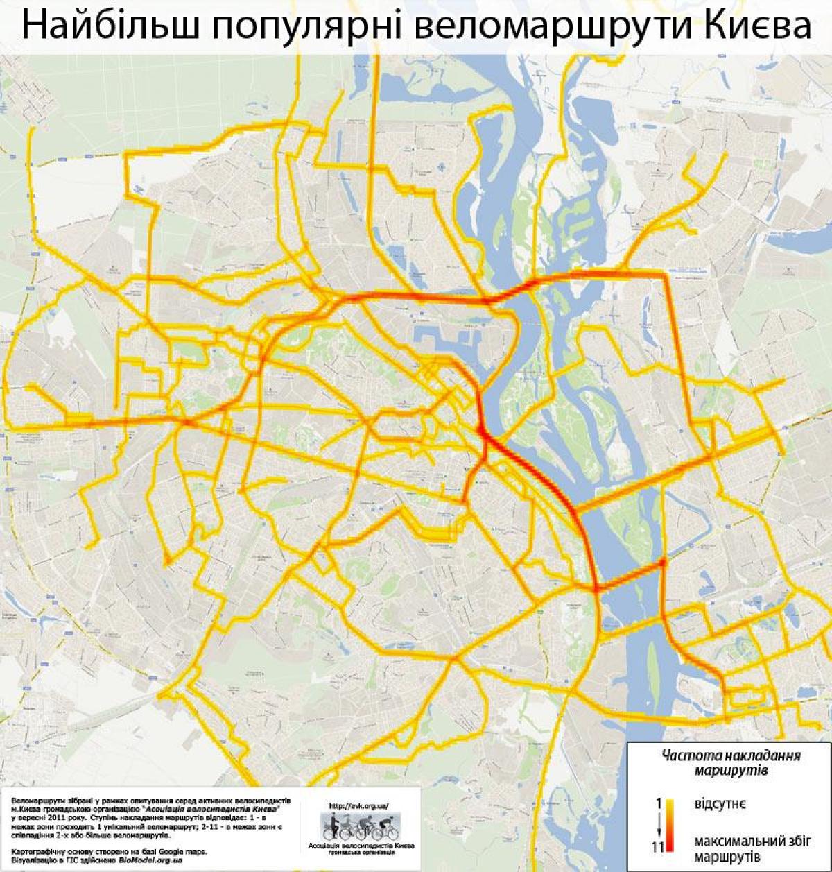
You can find on this page the Kiev bike map to print and to download in PDF. The Kiev bicycle map presents the bike routes and lanes of Kiev in Ukraine.

The Kiev bike lane map shows all the bike routes of Kiev. This bicycles lanes map of Kiev will allow you to easily plan your routes with a bike in Kiev in Ukraine. The Kiev bike lanes map is downloadable in PDF, printable and free.
The new plan includes for Kiev bike lane establishing more than 240 kilometers of bicycle routes in the nearest years, as well as up to 16 kilometers of bicycle tracks merged with public transport lane. Thus, we can expect a new bicycle route Poshtova Ploshcha — Paton Bridge in the nearest future. By 2025 Kyiv is expected to boast of three main routes: Vynohradar — Downtown, Solomianka — Downtown, and Obolon — Podil. Besides, metro stations will be equipped with bicycle parking, which will ensure comfortable trips on public transport for cyclists. Pushcha-Vodytsia as its shown in Kiev bike lane map is not only a nice get-away spot for a weekend but also a popular cycling location. The solid soil route occasionally changed by sand makes up 11,7 kilometers in total. Experienced cyclists advice to skip this location in case it has rained a day or two before, as the bike might get stuck in the mud. Pushcha-Vodytsia is easily reached by tram #12 that goes from Kontraktova Ploshcha.
One of the most popular locations for local cyclists, the route from the Muromets (or most commonly known as People Friendship) Park to the Muromets Island is equipped with a bicycle track, suitable for rookies and professionals. Besides, the island hides a pump track. The route is 8,4 kilometers long and takes 40 minutes to complete as you can see in Kiev bike lane map. The territory has numerous cafes and bike rentals. The long asphalt quay seems to have been made specifically for bikes. Firstly, the surface makes it easy to navigate and take a stop to enjoy the picturesque views of the Dnieper River. Obolon Quay has various cafes and supermarkets, so picnic might be a logical continuation of the bike trip. The route is suitable for rookies, being only 4,1 kilometer long. Two bike rentals are available near the Quay.
Syretskyi Park as its mentioned in Kiev bike lane map is a small paradise of nature hidden among the Kiev busy roads near the Syrets metro station. Visited mostly by locals from the neighboring houses, it is a perfect location for quiet cycling and cherishing nature. Rookies might want to keep to the steep track, while those experienced will enjoy hills abundant in the park. The surface is changing from asphalt to soil, with an overall length of the route being 2,4 kilometers. One more route that lets one enjoy the wonders of fresh air away from the busy streets, Holosiivskyi Park is nevertheless pretty easy to reach – orient on the Expocenter of Ukraine located on the Vystavkovyi Tsentr metro station. The territory is truly vast – more than 45 square kilometers riddled with unique and sometimes rare trees, bushes and flowers. The lucky ones have a chance to meet curious squirrels, swans, and twittering birds. Due to the diversity of the spot, local cyclists make routes considering for their skills and needs. For instance, there is a 6,3-kilometer route on asphalt and soil suitable for those with minimum cycling experience. Information signs installed on the routes wont let the enthusiasts get lost in Holosievo.
