

You can find on this page the Kiev topographic map to print and to download in PDF. The Kiev elevation map present the topography, river and relief of Kiev in Ukraine.
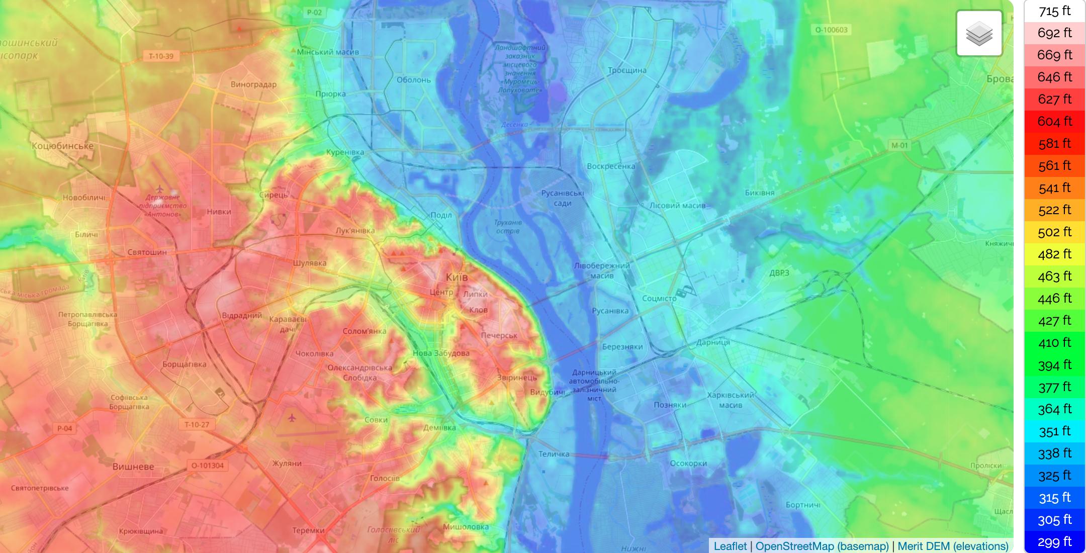
The Kiev topographic map shows elevation, hills and landforms in Kiev. This elevation map of Kiev will allow you to know topography, river and relief of Kiev in Ukraine. The Kiev topographic map is downloadable in PDF, printable and free.
The Elevation map of Kiev displays range of elevation with different colours. The elevation map of Kiev is generated using elevation data from NASA 90m resolution SRTM data. The maps also provides idea of topography and contour of Kiev. Coordinates : 50.29003 30.36414 50.61003 30.68414. Minimum elevation : 86 m. Maximum elevation : 213 m. Average elevation : 132 m.
The city is located at an elevation of 587.3 feet (179 meters) on both sides of the Dnieper River, which flows south towards the Black Sea as you can see in Kiev elevation map. The older right-bank (western) part of the city has numerous woody hills, ravines and small rivers, and is a part of the larger Dnieper Upland adjoining the western bank of the Dnieper. Kiev expanded to the Dnieper's lowland left bank (to the east) only in the twentieth century. Significant areas of the left-bank Dnieper valley were artificially sand-deposited, and are protected by dams.
The Carpathians are a real pearl of Western Ukraine, located 650 to 750 km from Kiev, it is its highest elevation point. Fresh air, great mountains, unique landscapes, beautiful national parks, and a wide choice of mineral and thermal waters make the Carpathian range an extremely popular tourist attraction. The carpathians with its 51 kilometres of pistes of varying difficulty and length is Ukraine biggest and best equipped winter destination as its mentioned in Kiev elevation map.